Glenorchy does not have a place like Sullivans Cove where many 19th century buildings can be seen in plain view. They are in fact hard to avoid. But Glenorchy does not. It has many small, inconspicuous, hard to find, pieces of history. While some are well-known like the Austins Ferry Cottage, most are small. Many which only the dedicated searcher with a good map could find. Many which people might pass without noticing. Easily overlooked. A well in Austins Ferry. A small bridge in Claremont (Windermere).
On Monday (16/2/26) the Glenorchy Planning Authority (view agenda) will discuss an application for a subdivision in Chigwell in which a “local heritage place” plays a part. It appears in the list of officially recognized “local heritage places” in our planning scheme. It is described as:
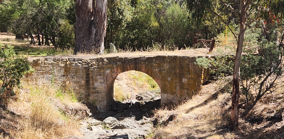
“A 19th century culvert spanning Faulkner’s Rivulet and marking the location of an all-weather historic carriageway from the Main Road through what was part of the Lowestoft property. The culvert demonstrates 19th century road construction techniques that potentially reflect the scale of infrastructure projects able to be undertaken on large country estates under Lieutenant-Governor Arthur’s system of convict assignment.“
It is considered worthy of listing because:
- it is a fine and intact example of a 19th convict period bridge (culvert) constructed in permanent materials, that demonstrates the scale of projects able to be undertaken on large country estates and provides insights to the characteristics of all-weather land routes of that era that are locally uncommon.
- it exhibits the principal characteristics of a 19th century masonry bridge (culvert) forming part of an historic rural land route.
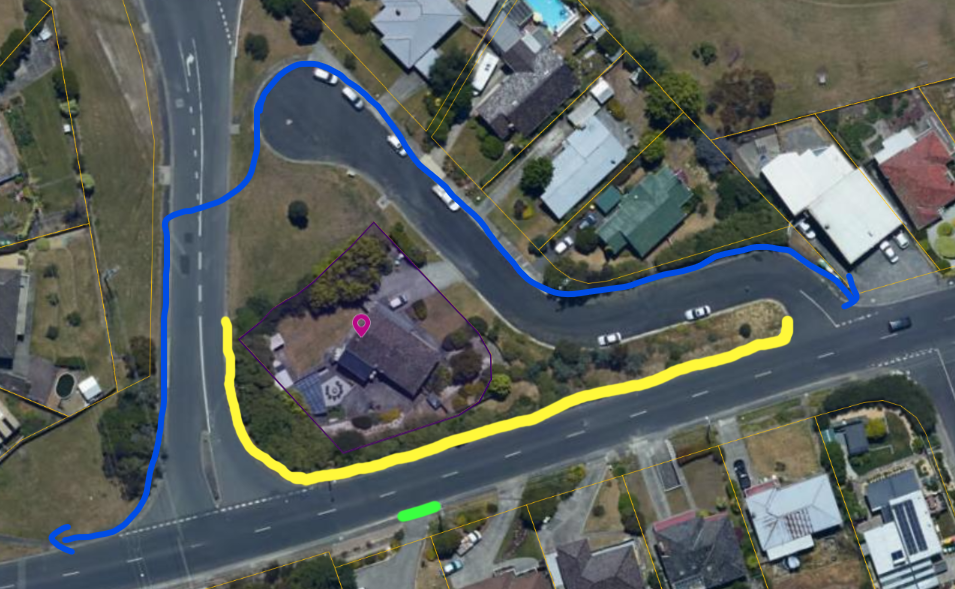
The presence of the bridge, labelled as Lowes Bridge in Google Maps, is uncontroversial. The bridge is on a portion of the parcel to be subdivided that is of no value to the developer. The proposed solution will extend the land on the other side of the rivulet to, in effect, produce a Public Open Space to be managed by Council. A convenient donation to Council by the developer.
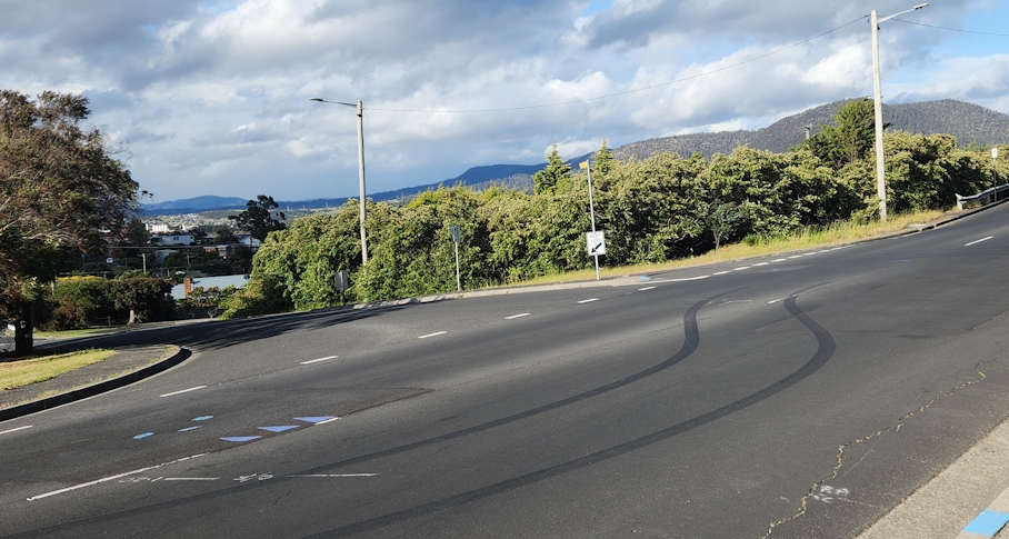
But if you were to visit the bridge, you would need a map. There is no signage indicating its existence or anything that you could describe as useful for wayfinding. Without a map you would walk past it without noticing it. It is not on any tourist trail – it will not be found accidentally.
The bridge goes nowhere. It starts on weeds and grass for which mowing appears to be the only maintenance. It ends in bushland, bushland which seems to teem with wildlife.
It is not a destination that attracts. Nowhere to sit and rest. No recreation facilities of any sort. Google Maps also shows a “water filling station” within a few metres of the rivulet. It is locked and covered in cobwebs. The condition of the bridge makes it unsafe for activity, certainly for children.
So it is unsigned, it is hidden off-street, it has no facilities, it is unsafe. It is nowhere near any site promoted for tourism by Council or anyone else.
One of the sources below says it “enjoyed by the community of Chigwell and is a treasured place in the local environment.” A laughable statement unless my eyes deceive me.
So what is the culvert being protected for?
Sources
Photo from “Glenorchy 1804 – 1964” book by Alison Alexander published by Glenorchy City Council in 1986, page 10, source given as Mr J. Hinks, very similar to current bridge but not confirmed as the bridge in this article.
Listing in Glenorchy Planning Scheme – https://tpso.planning.tas.gov.au/tpso/external/planning-scheme-viewer/15/section/2431?effectiveForDate=2026-02-14
Chigwell History Project – https://glenorchyarts.com.au/lowes-bridge/, https://www.tasfamily.net.au/~schafferi/index.php?module=blog2&page=viewpost&post=chigwell-project-2004.php&pageback=kop32.php
Notes
Close examination of the current bridge certainly give the impression of extensive “repair” or “renovation” at some point. By Council? So it is not clear how much of the current bridge is 19th century. Research?